Friday, August 17
Watson Lake, YT to Tatogga, BC
238 miles; sun and clouds, overcast, smoke; temps 50
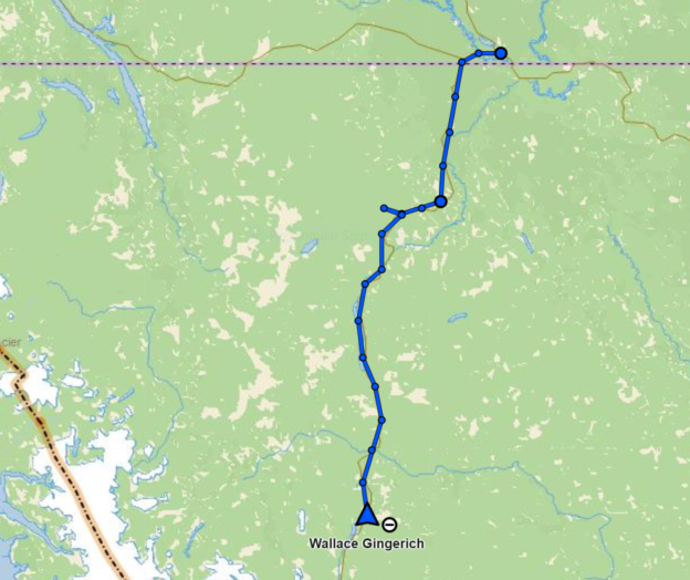
It was sunny for the first hour today but then the clouds came in and soon it was completely overcast. Temperatures hovered around 50 all day, chilly under overcast skies and occasional very light rain.
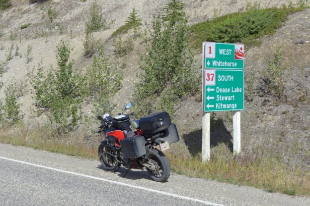
I wanted to ride the Cassiar in 2007 on my way back from Alaska, but it was not paved all the way and those sections could be challenging for the Blue Pig (BMW K1200LT). I decided to wait until I was on a more capable bike. Now the road is completely paved.
Right away it was clear this was going to be an interesting road – smaller, narrower berms, shorter set backs, and less leveling and straightening that that on the Alaska Highway. I liker roads like this because I feel more a part of the area I’m riding through.
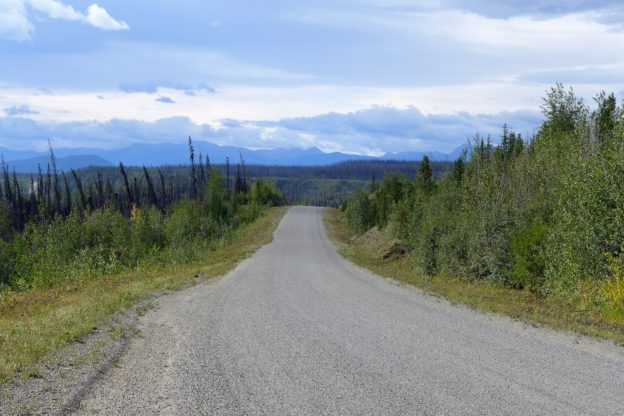
About 50 miles south of the Alaska Highway the Cassiar begins to traverse the Cassiar Mountains. This are a scenic, rugged range, and the road follows right along the base of the mountains. I was really enjoying the road, the views, and the absence of trucks and heavy traffic.
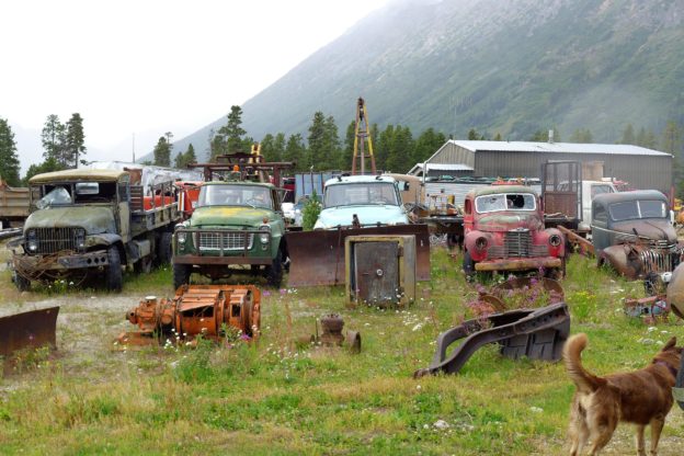
Just south of Good Hope Lake I turned off on the 12 mile dead end road to Cassiar, an abandoned company town established by an asbestos mining company. A friendly dog, probably owned by an older cigarette smoking lady I saw, was roaming around. Lots of abandoned vehicles and mining machinery were setting around.
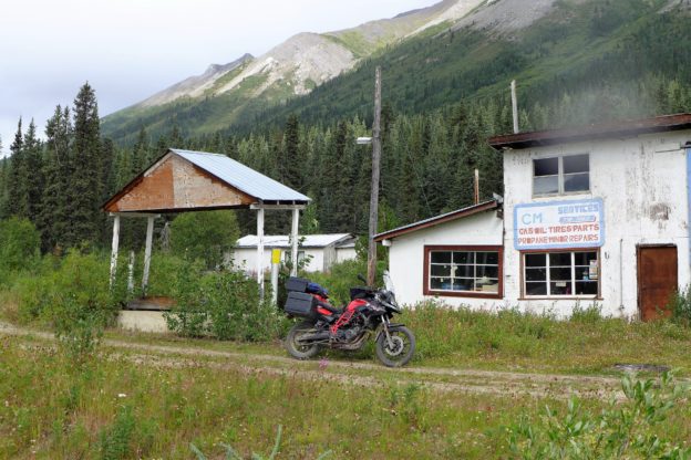
I pulled up at the abandoned service station. It probably did a good business when the town was in its prime with 1,200 residents.
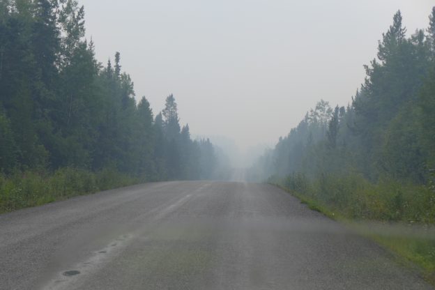
Just north of Dease Lake smoke from forest fires burning in the Telegraph Creek area to the west began to settle in. With the overcast skies, thick smoke and the smell of fire in the air it was a gloomy, kind of depressing ride.
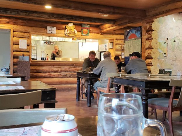
I’m spending the night at Tatogga Lake Resort, one of very few accommodations along the Cassiar Highway. It turns out that the entire resort is being run by an older gentleman. He was cleaning the motel rooms when I got here, with the help of some volunteer workmen who are staying at the resort. In the restaurant it was pretty much self-serve. I ordered the spaghetti and meatballs, but learned later that everyone got hamburgers no matter what they ordered. As the crowd got larger some of the workmen helped out in the kitchen, too. The burgers were surprisingly good!
Saturday, August 18
Tatogga, BC to Stewart, BC
192 miles; sun and clouds, temps 60’s and 70’s

I got a late start today (11:30 AM) after a leisurely breakfast at the Tatogga Lake Resort. This was another short ride, down to Steweart, BC and Hyder, AK. The weather was gorgeous today, the smoke was gone, and the road and scenery were spectacular.
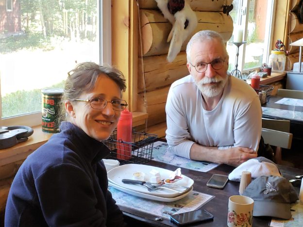
At breakfast I met Catrina and Bill, a lovely couple from Whitehorse who are taking a week long vacation on their motorcycles. They gave me the inside scoop on bike shops in Whitehorse, and the road up to Inuvik and Tuk. Because of the fires in southern BC Catrina (yes, spelled with a “C”) suggested I think about riding over to Prince Rupert and taking the BC ferry down to Vancouver Island, ride down to the south end, and take a ferry over to Washington State, avoiding all the smoke and heavily traveled roads in southern BC. I’m looking into that to see if I can get a reservation, and if I can I’ll do it. They said the scenery on the Island is magnificent and the roads lightly traveled.
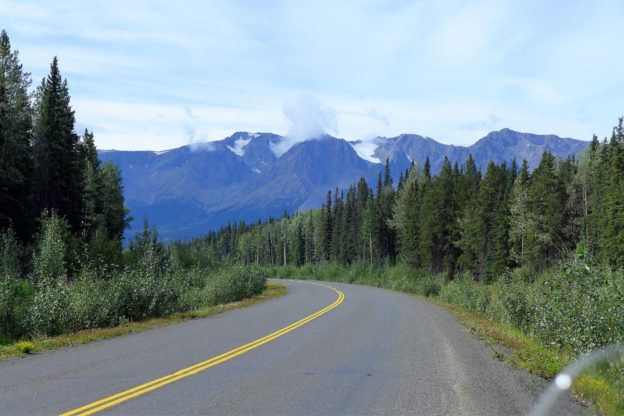
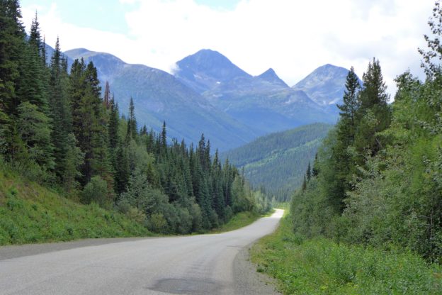
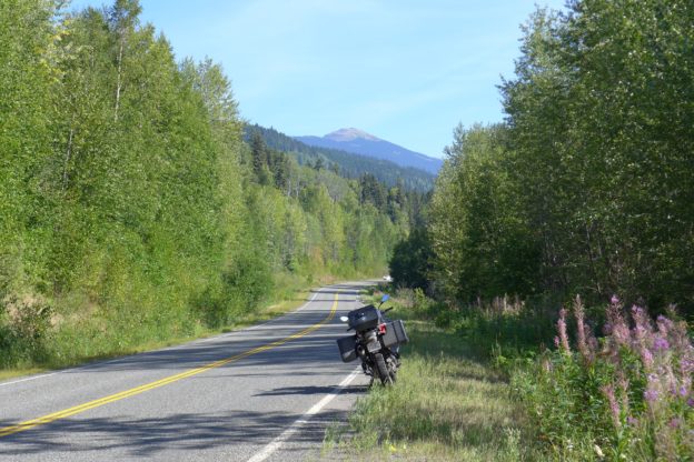
This is a typical view from another typical day on the Cassiar – just spectacular mountain scenery everywhere you look.
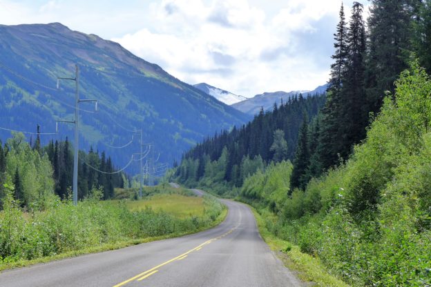
As I got further south the mountains became more rugged, the valleys narrower, and the road smaller, squeezed into the available space. I’m running out of superlatives to describe the Cassiar Highway – it is now high on my list of great riding roads.
At one point the road came so close to the mountains that I felt I could almost reach out and touch them. I could easily see individual trees on the mountain and make out details all up the mountain.
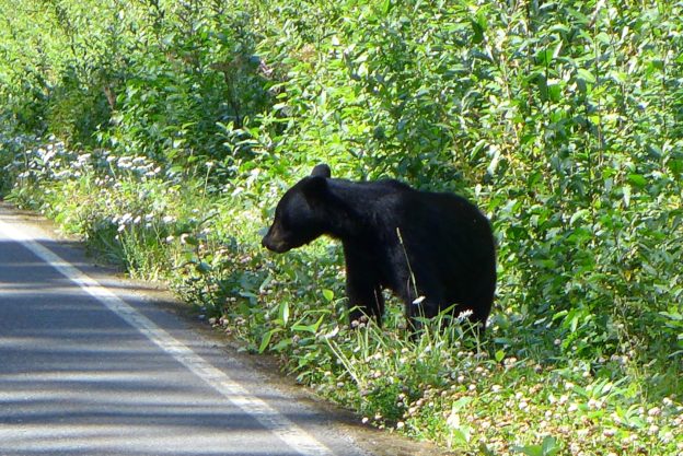
Before long I spotted a bear munching grass along the side of the road. I passed by, turned around and snapped this photo. Then I pulled up opposite him on the road but by the time I got my camera ready he ran off into the woods. Not a mile further along I saw more; the one I noticed first was a hundred yards down the road and he scampered into the woods then, before I knew it, another one dashed across the road right in front of me and I had to brake hard to avoid hitting him. I was a little shook up – I had no idea a bear might run in front of me. I kept a sharp eye out from then on.
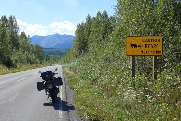
And then, a couple miles further along I saw a sign warning of bears in the area. A little late for me, it turns out.
Bear Glacier comes right down to the level of the road, just a couple of miles outside of Stewart. The mountains are doted with glaciers, some of them visible from Stewart’s main street. Tomorrow I’m going to ride over to Hyder, AK and past to see Salmon Glacier.
Sunday, August 19
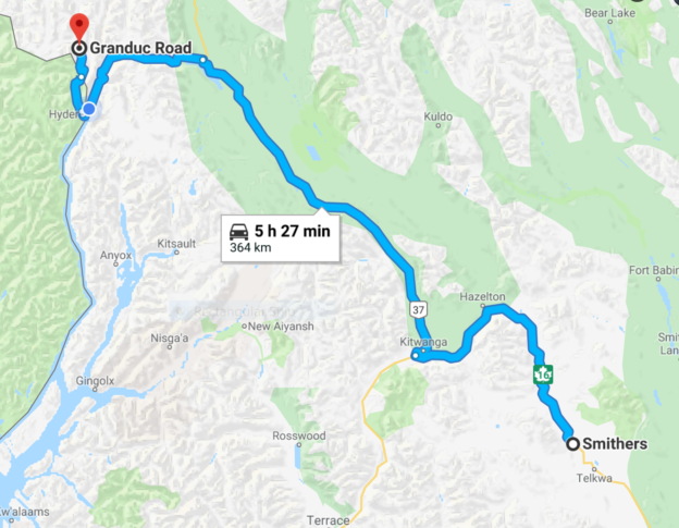
Stewart, BC to Smithers, BC
251 miles; sun and clouds, temps in the 70’s
This was another gorgeous British Columbia day, sunny skies, temperatures in the 70’s, light traffic, beautiful scenery.
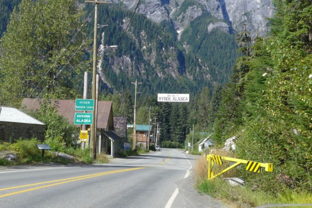
Hyder, Alaska has the reputation among BMW riders of being a quaint, quirky place, and definitely worth a visit. It’s well known in part because it is the southern most part of Alaska reachable by road, so if you want to go to Alaska this is the easiest place to get to. I was mainly interested in Hyder because it’s a place where you are supposed to be able to see bears, and it leads to the road up to Salmon Glacier. There weren’t any bears today, so I proceeded up the road to the glacier.
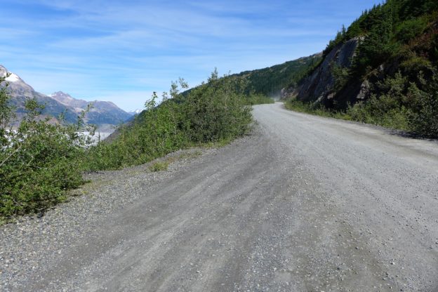
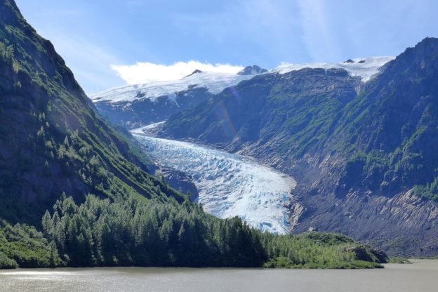
Granduc Road follows the Salmon River from Stewart/Hyder for 23 miles up to the glacier at 4,300 feet. Most of the road is gravel and the last eight miles or so are steeper and narrower, with sharp drop offs, so it is an exciting road to ride. And of course glacier topped mountains were all around.
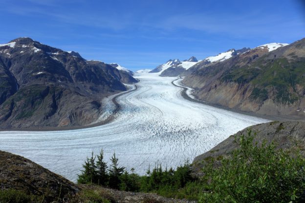
This photo of Salmon Glacier in no way captures the spectacular size and grandeur of the glacier, the sixth largest in Canada. The glacier extends about six miles up to the top of the ridge, and another two miles to the left. It is HUGE! Scientists expect it will be completely melted in 75-100 years. The Coast Mountains all the way up to the Elias Mountains contain hundreds of glaciers.
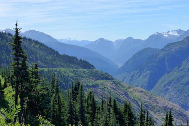
Riding back down from the overlook the Coast Mountains to the south provide a dramatic backdrop for this picture of the road going down the side of the mountain.
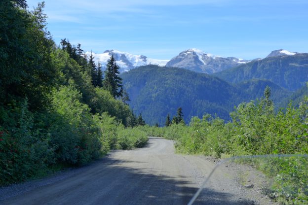
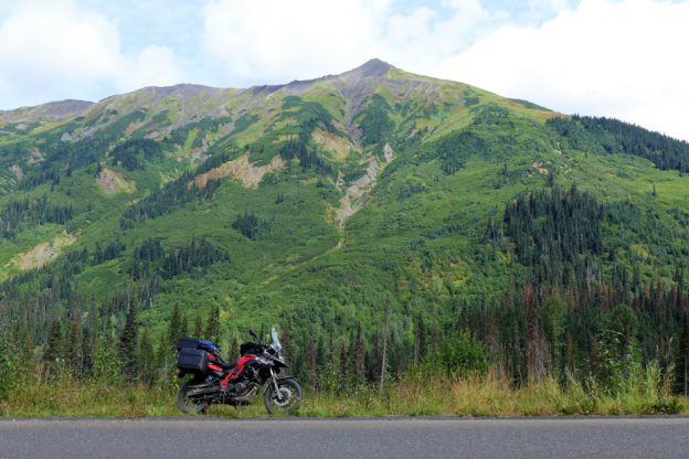
Part of what makes this road so special is how small it is and how close it puts you to the natural surroundings. And, of course, the rugged mountain scenery just tops things off.
So, back down from Salmon Glacier, through Hyder and Stewart and out to route 37, the main route of the Cassiar, I continued south for 100 miles to the junction with Trans-Canada Highway 16 at Kitwanga, where the Cassiar ends. The Cassiar has become one of my most favorite roads – it is small with few services and it traverses remote northern mountain country. The people you meet along the way, the travelers and those running the establishments, are adventuresome types and friendly and helpful. And with a bit of luck you will see a variety of wild animals, particularly bears. I was a bit wistful as I turned onto route 16 to head to my motel in Smithers. The Trans Canada was an abrupt change.