Track me via satellite!
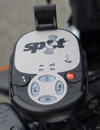
SPOT satellite tracker
Click on the Find Me Spot link at the top of the sidebar on the right and you can follow me on via satellite tracking made possible by this slick little gizzmo by findmespot.com. My SPOT has a GPS in it to track my location and a satellite radio to upload the corrdinates to the FindMeSpot website where they are displayed on a map. I usually send several “I’m ok” messages during the day, and an “I’m here for the night” in the evening. When we’re riding the Trans-Lab I’ll put it on automatic tracking and it will log in every 10 minutes. That little red button is for sending an SOS which is relayed to the nearest emergency responder (i.e., 911) in the event we get in serious trouble.
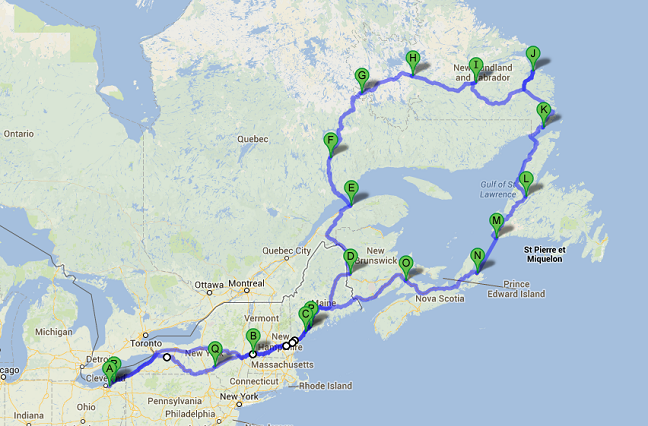
Itinerary
| Day | Date | Miles | Map Key | Destination | |
|---|---|---|---|---|---|
| A | Shaker Heights, OH | ||||
| 1 | 30-May | 548 | B | Bennington, VT | |
| 2 | 31-May | 194 | C | Topsham, ME | |
| 3 | 1-Jun | C | layover | ||
| 4 | 2-Jun | 294 | D | Woodstock, NB | |
| 5 | 3-Jun | 268 | E | Matane, QC | |
| 6 | 4-Jun | 170 | F | Manic-Cinq, QC | (8 am ferry to Godbout) |
| 7 | 5-Jun | 222 | G | Labrador City, NL | |
| 8 | 6-Jun | 157 | H | Churchill Falls, NL | |
| 9 | 7-Jun | 181 | I | Happy Valley – Goose Bay, NL | |
| 10 | 8-Jun | 255 | J | Cartwright, NL | |
| 11 | 9-Jun | 211 | K | Red Bay, NL | |
| 12 | 10-Jun | 244 | L | Deer Lake, NL | (1 pm ferry to St. Barbe) |
| 13 | 11-Jun | 169 | M | Channel-Port aux Basques, NL | |
| 14 | 12-Jun | N | North Sydney, NS | (11:45 am ferry to N. Sydney) | |
| 15 | 13-Jun | 273 | O | Sackville, NS | |
| 16 | 14-Jun | 400 | P | Topsham, ME | |
| 17 | 15-Jun | 368 | Q | Sidney, NY | |
| 18 | 16-Jun | 410 | R | Shaker Heights, OH | |
| 4364 |