
 From Tok I took the Taylor highway north to the Top of the World highway to the Yukon border. Then the Klondike highway took me to Whitehorse, across the Alaska Highway, and all the way to Skagway. From there I retraced my route to the Alaska Highway and on south to Fort Nelson, BC.
Day 28 – Thursday, June 28 – Tok to Dawson City
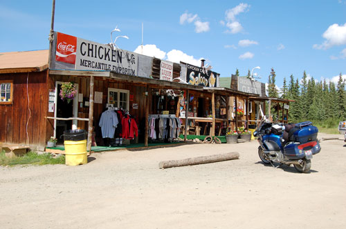
This morning I took the Taylor Highway northeast toward Chicken, and then on to Whitehorse. Chicken, a little place established during the gold rush, is reputed to be a wacky place, but I guess I wasn’t able to appreciate it. Residents supposedly wanted to name it Ptarmigan, after a common fowl in the area, but decided to name it Chicken since they couldn’t spell Ptarmigan. Good story…
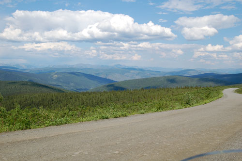
The road from Chicken to the Yukon border is known at the Top of the World Highway. It is mostly gravel and winds its way along the tops of ridges across the tundra, ranging between 3500 and 4000 feet altitude. The views were expansive.
It was at this pullout that I saw a young couple on bicycles having lunch and enjoying the view. I’ve seen a few bicyclists each day. I’m sure they experience even more of the surroundings than I do on my motorcycle, but I stick with my motorcycle. A guy at a stop yesterday told me of a British couple, middle-aged, who were riding their bike all the way up to Prudhoe Bay, and then down to Tierra del Fuego, the tip of South America!
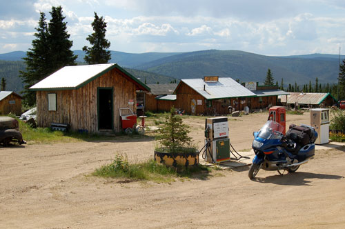
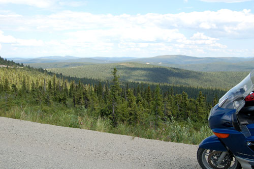
I stopped here to gas up, just to be on the safe side, but I couldn’t find anyone around. Luckily, I had plenty of gas to get to Whitehorse. One of the advantages of a motorcycle designed for touring is the large gas tank.
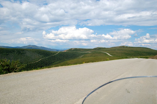
More of the beautiful, winding, Top of the World Highway to the Yukon border.
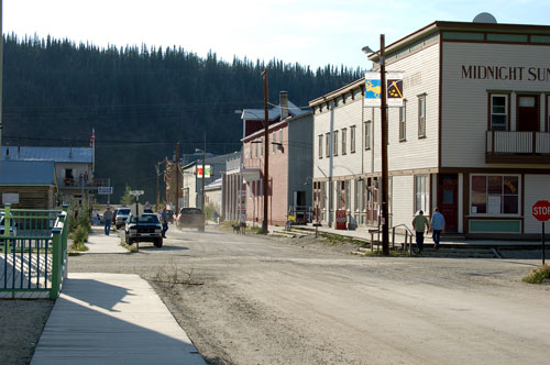
I got to Dawson City around 6 p.m. This was the center of the 1897 Klondike gold rush, and some of the original buildings are still here today. The sidewalks are mostly boardwalks. It gives one a bit of a feel for how “rustic” things were in those days.
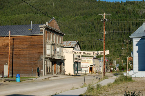
Here is the theatre district.
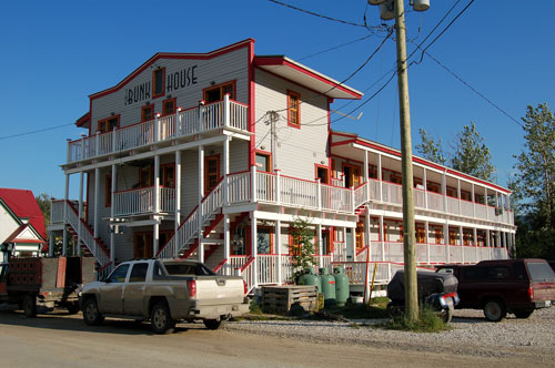
This is where I stayed for the night. The rooms on the second floor were very small and had no baths – the common bath was above my room on the first floor where I heard the comings and goings all night long. Luckily, I had opted for a room with my own bathroom.
Day 29 – Friday, June 29 – Dawson City to Whitehorse

Before leaving the Dawson area this morning I wanted to see where the Klondike Gold Rush started. This is the site of the original discovery made in 1896 along a small tributary of the Klondike River. News of the discovery reached the lower 48 in 1897, and by 1898 the population in the area had grown to around 40,000.
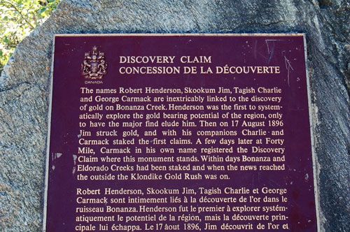
The plaque describes the chain of events that led to the Klondike Gold Rush.
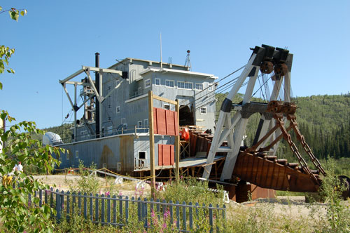
The original placer mining methods were extremely rudimentary and eventually gave way to more mechanized methods such as dredges like this one. The river beds in the area still show the effects of the dredging – slurry is piled up along the riverbeds for miles.
Day 30 – Saturday, June 30 – Whitehorse
Today I slept in, then spent the day catching up on my website, doing laundry, washing my bike (again), and doing a little work organizing a session for our social work education meetings this fall.
 |
 |
|
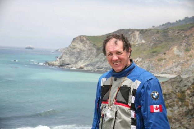
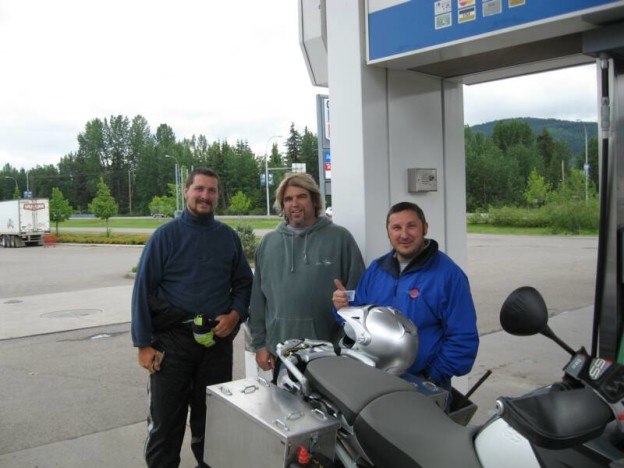
This is Rollie. |
This is Ernest (on the left). |
At the car wash I met Rollie and Ernest, a father-son duo from Labrador and Newfoundland. They pulled in behind me to wash their bikes and we immediately struck up a conversation. Rollie had worked for the Iron Ore Company of Canada in Labrador City for 40 years, and had dreamed of riding to the Yukon and Alaska with his son Ernest. After his wife of 32 years died suddenly last year he took stock of things, retired and decided 2007 would be the year for the trip. He and Ernest bought new fully equipped BMW GS Adventure bikes. They started from their home in Newfoundland, rode south along the east coast of the U.S. to the Florida Keys, across the south to the Pacific coast, then up the coast through British Columbia, Alaska, and now the Yukon. My brief conversation with Rollie was inspiring and uplifting. He and Ernest were obviously having a great trip, and it validated my decision to take my own adventure.
What started out to be a ho-hum day for me turned out to be a marvelous gift! The many interesting people I have met on the trip have really added to my enjoyment of my adventure.
Day 31 – Sunday, July 1- Whitehorse to Skagway
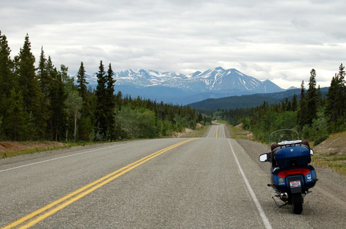
I set out for Skagway this morning. It was Sunday, the weather was overcast and in the 60s, the traffic was light, the scenery was spectacular, and the bike was running beautifully – all was right with the world.
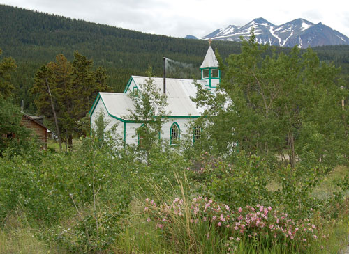
I took the cutoff for Carcross, and on the way into the village I saw this little frame church. Services were going on and the sweet smell of incense was wafting out of the chimney. The church had been established by Russians about the time of the gold rush stampede.
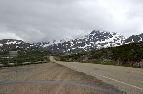
As I approached White Pass, one of the routes to Dawson City and the gold rush it got cooler – down into the low 50s. I put on my heated vest for the first time on the trip and if felt very toasty.
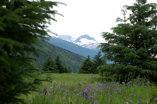
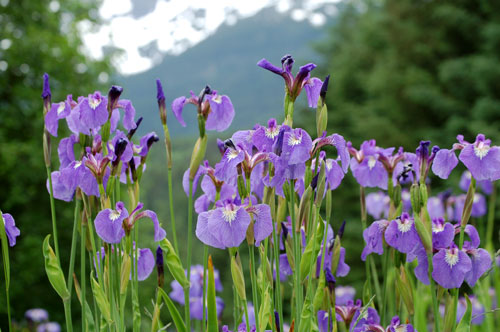
Before getting to Skagway I took the turnoff to Dyea, the abandoned site where the Chilkoot Trail began. There is nothing left of the town now except a few remains of buildings and other artifacts as you can see here. Dyea exploded from nothing to over 20,000 residents in 1897, but within 3-4 years it had been abandoned. The new railroad from Skagway to Whitehorse rendered the Chilkoot Trail unnecessary, and Skagway had a much better harbor. The abandoned Dyea site is now graced by many varieties of wild flowers…
 |
 |
 |
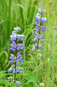 |
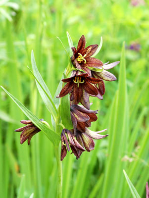
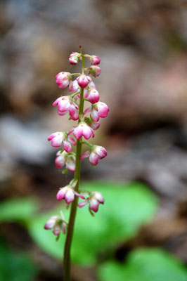
| Wild Iris | Chocolate Lilly | Wintergreen | Lupin |
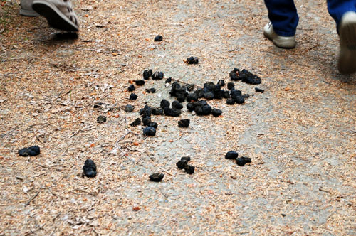
The ranger warned us to be on the lookout for bears – both brown and black. We found some fresh scat on the trail, evidence that bears had been here within the last few hours. We didn’t see any on our hike, however.
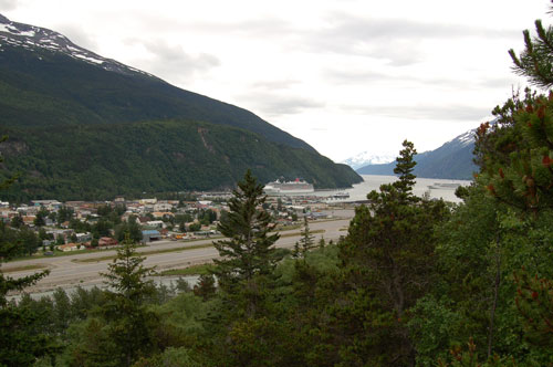
Skagway is nestled in a fjord that provides a very deep port. The little town has become a popular stop for the cruise ships that go up and down the inner passage.
Day 32 – Monday, July 2- Skagway to Fort Nelson
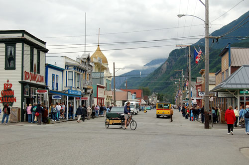
Last night when I walked out on Broadway to find something to eat it was almost deserted. This morning, with 4 cruise ships docked at the end of the street behind me Broadway is a beehive of shopping activity.
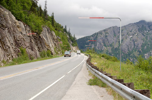
I had to ride back up over the White Pass this morning to get to the Alaska Highway and on toward home. I’ve seen these elbow shaped markers at quite a few places on the roads, and I’ve finally figured out that they mark the edge of the roadway for the snowplows. The markers going down to Valdez were even higher than these!
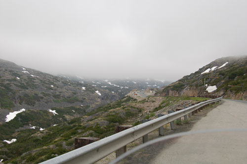
As I neared the pass the clouds were low enough to almost cover the road, but not quite.
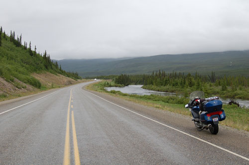
The road from Skagway all the way to Fort Nelson, Yukon, was at fairly high elevation, ranging between 2,000 and 3,000 feet. It was cloudy and overcast with light rain all day, with the temps in the mid-50’s. I didn’t mind, since I was dressed for warmth and my gear is rain-proof. I saw quite a few motorcyclists today, most of them going north, but a few going south like me.