Wednesday, August 1
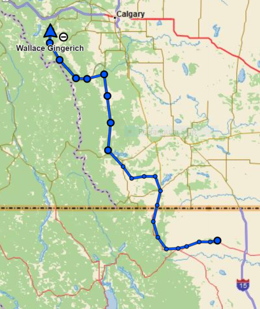
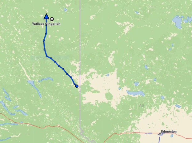
Cut Bank, MT to Kananaskis, AB
315 miles, hazy sun, temps 62 to 94
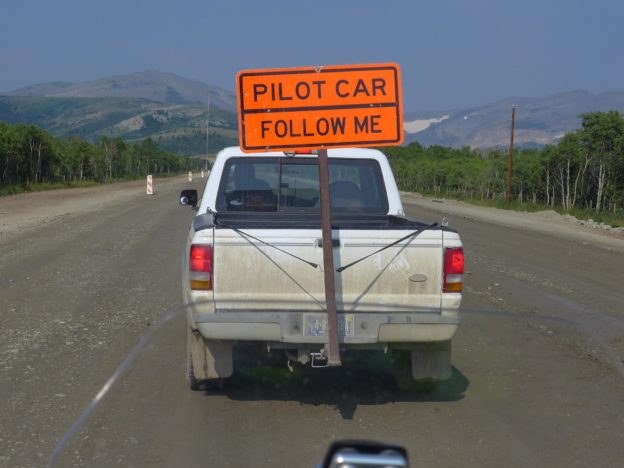
We took US 89 from Cut Bank north into Canada and encountered the first of what will be many road construction sites. While waiting for the pilot car I had a very interesting conversation with a full blooded Black Foot Indian woman who was directing traffic. She was proud to be Native American (we were here first), and even more proud that her son attended the private school in Washington, DC that the Obama children attended. She showed me a photo of her son with Michelle Obama. She plans to become a doctor and she hopes he will come back home to practice.
US 89 north to the border was rather scenic, threading up through the foothills of the Rockies.
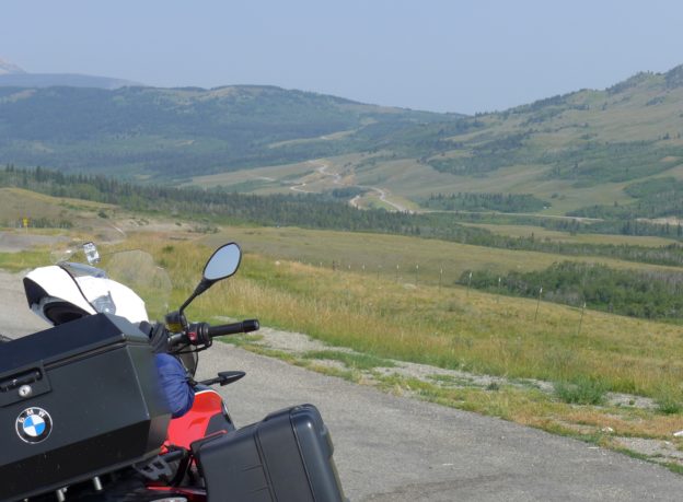
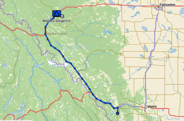
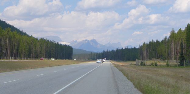
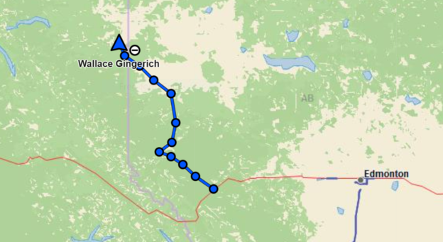
We took the Kananaskis Trail (Provincial Route 40) northward toward Banff, but I was somewhat disappointed. I had expected to see more wildlife (we saw only a few Rocky Mountain Sheep) more dramatic mountain scenery, but it was a much more scenic and relaxing route to the parks than the much traveled route through Calgary.
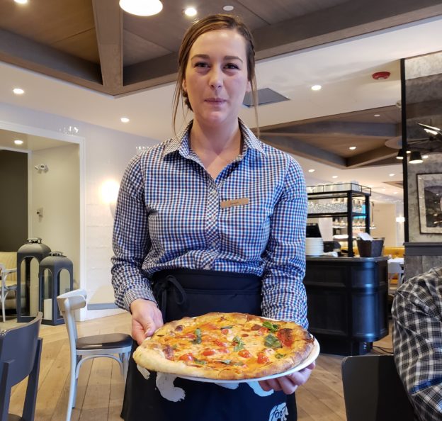
The high point of the day again was an interaction we had with an interesting person we met on our way. Trinity is from Tasmania and working at the Mount Kidd Manor Resort where she served us a savory Italian dinner. She was efficient and charming, and took very good care of us. Although she loves Canada she will be returning to Tasmania in a few months.
I was very tired this evening – the 8-10 hour days on the bike are taking their toll. Fortunately we’ll have somewhat shorter days for most of our riding in Canada, and a layover day in Whitehorse will give us a chance to rest up before we head up the Dempster to Tuk.
Thursday, August 2
Kananaskis, AB to Hinton AB
273 miles, hazy sun, thunderstorm, temps 51 to 70
We left at 9 AM thinking this wouldn’t be such a big day, but we didn’t get to our motel in Hinton until 6:30 PM. Lots of stops today for pictures, replaced a headlight bulb, gased up among multitudes of vacationers, had a relaxing picnic lunch, and time slipped away. Amazingly I don’t feel tired tonight but energized by our ride today. Tomorrow shouldn’t be as long, however.
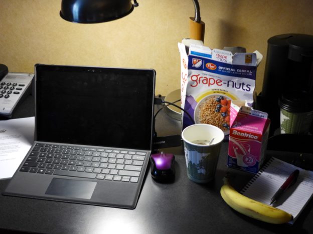
Breakfast this morning in our room. I bought a box of Grape Nuts a few days ago just for times like this when reasonably priced breakfast wasn’t available or all the motel was serving was sugared cereal. You can usually find milk and a piece of fruit and get coffee in the room. Just like home!
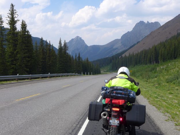
Today’s ride was up the Icefields Parkway through Banff and Jasper National Parks. But we took an alternate route for the first few miles, the Bow Valley Parkway, and I’m glad we did. It was a small, winding two-lane road with little traffic. In addition to taking in the scenery which seemed like just an arm’s reach away, we breathed in a deliciously sweet, incense-like fragrancecthat I couldn’t identify. I think it must have come from some of the bushes. I was struck again how riding small roads makes you a part of the surroundings and provides a feast for the senses – the smells, sights, sounds and even touches of the world around you.
Soon we got back on the main road, a four-lane divided highway, and we could no longer smell the sweet smell of the forest but instead attended to the sights and sounds of traffic. The trees and mountains now seemed far removed; we were passing through rather than being part of our surroundings.
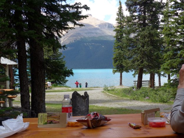
We picked up picnic stuff at Lake Louise and found this idyllic spot on Bow Lake for lunch.
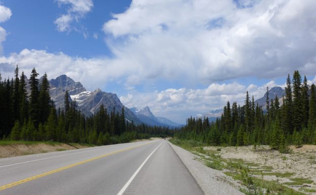
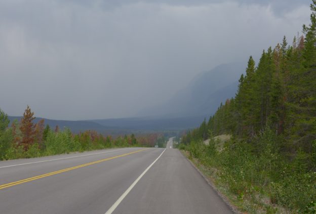
North of Lake Louise the Icefields Parkway becomes a two-lane road, and the views become even more spectacular.
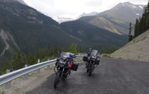
The Parkway climbs higher as it approaches the Columbia Icefields. The twin GSes are taking a brief break here before proceeding over the pass.
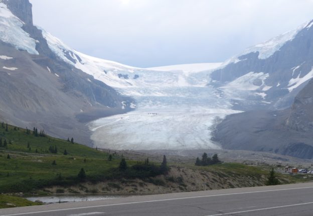
And here it is, the Columbia Glacier. Looking closely you can see touri. sts up on the glacier. This is only one of many glaciers along the Parkway, truly stunning sights to see.
Before long, at the upper elevations, it clouded up and we rode into a thunderstorm, heavy rain and high wind gusts, but in ten minutes it was over. But now that our gloves were soaked and the temperature dropped to 51 degrees, we were cold!
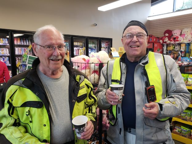
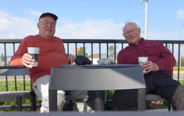
Before too long it we were in Jasper and it was time to gas up, so we treated ourselves to coffee. Thanks to a wonderful German family for taking the photo.
Today, traveling at speeds of 40-60 mph, I was getting a little over 60 mpg, just as I normally get when riding at “normal” speeds. So we should do just fine on our way up the Dempster where we will have one stretch of 230 miles without a gas station, plus we each carry extra gas.
Our ride today confirmed for us that the Icefields Parkway is indeed one of the most spectacular roads in North America. One hundred and forty-four miles of well-maintained highway lined with colorful wildflowers and bordered by glacier-capped mountains and spectacular emerald blue mountain lakes, all punctuated by rapidly changing alpine weather. A ride to remember…
Friday, August 3
Hinton, AB to Dawson Creek, BC
285 miles, overcast then sun, temps 51 to 70
It started out cool and overcast today but warmed up later when the sun came out. We got to Dawson Creek by 3:30 (Pacific time), time enough to relax and rest up a bit and do the laundry.
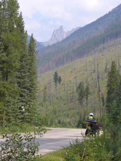
Provincial route 40 from Hinton, AB north to Grand Prairie terses the forested foothills of the eastern slope of the Rockies, is quite remote and lightly traveled, and scenery is wonderful. This morning, with the overcast skies and cool temperatures, the road had a melancholy feel to it. Melancholy, but pleasant.
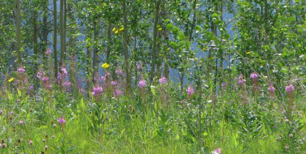
As the sun came out I noticed a patch of wildflowers against a backdrop of Quaking Aspens along the top of a ridge fencing off the valley below.
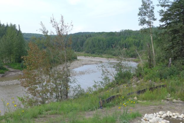
The Cutbank River is one of many flowing eastward out of the Rockies. From about Jasper north the rivers eventually flow into the mighty Mackenzie River that flows northward and empties into the Beaufort Sea close by Tuktoyaktuk. The Mackenzie watershed is huge.
Tomorrow we head up the Alaska Highway toward the Yukon. The trip is going very well, even if we do feel tired at the end of the day, but what would you expect for 73 and 83 year old riders?
Saturday, August 4
Dawson Creek, BC to Fort Nelson, BC
278 miles, overcast then sun, temps 55 to 80
Things started off cool this morning and then we ran into a rain shower and the temperature dropped to 55. My early afternoon the sun came out and it warmed up to 80 by the time we got to our motel. This was a real transition day. By the time we were 200 miles north of Dawson Creek the traffic really thinned out and we saw only tourists and a few locals on the road – almost none of the huge oil trucks.
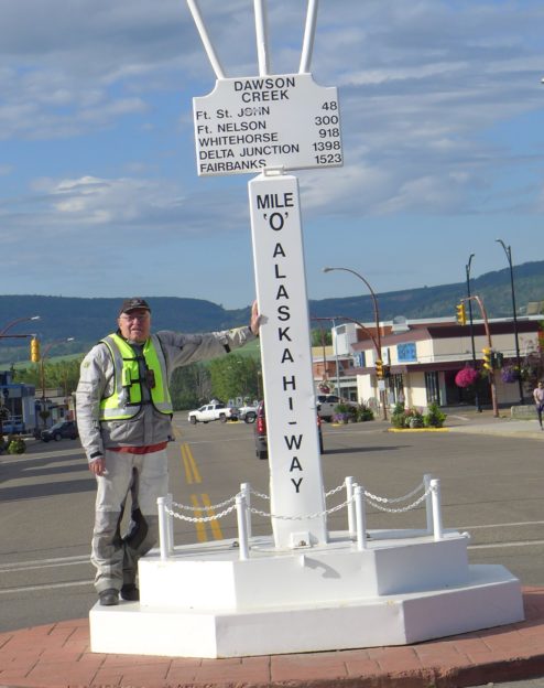
Today we got on the Alaska Highway and will take it up to Whitehorse where we’ll take the Klondike Highway to Dawson City, and from there the Dempster north to Tuk. The ALCAN (Alaska-Canada Highway) was completed during World Way II to connect Alaska with the lower forty-eight for defense purposes.
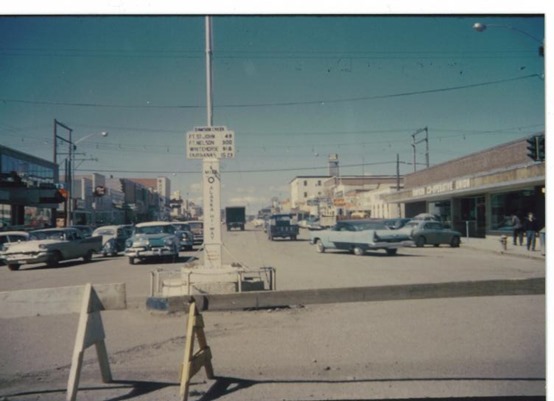
I first took the ALCAN in 1958 with my family, when all 1500 miles of it were gravel. We drove it in our 1957 Chevy and camped all the way up and back. Now that I think about it, today is 60 years almost to the day that my family and I were here and dad took this photo with his compact Bolsey 35 mm camera.
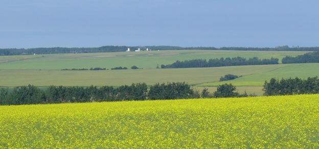
North of Dawson Creek we saw a fair number of farms, this one raising rapeseed that is used in cooking oil and bio-diesel fuel.
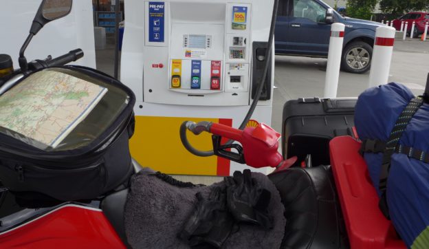
We stopped 40 miles up the road at Fort St. John for coffee – probably our last Starbucks until we get back to the States. We also gassed up, not knowing if we’d be able to get gas the next 230 miles to Fort Nelson.
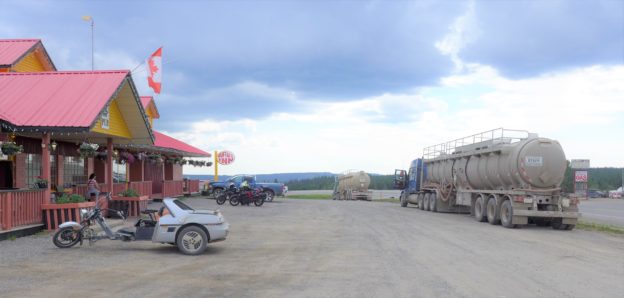
But, lo and behold there was a hotel and restaurant, and gas across the road, at Pink Mountain (mile 143 of the ALCAN). This is pretty typical for roadside stops along the ALCAN – a restaurant, sleeping rooms, and gas pumps. There were still a few oil trucks this far north – they are huge with three axles front and back, and some of them even pull a second tank behind. This guy was hauling what he called “sweet water” for the fracking wells, water and some sort of chemical cocktail minus an acid that is used in “sour water.”
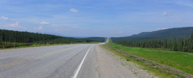
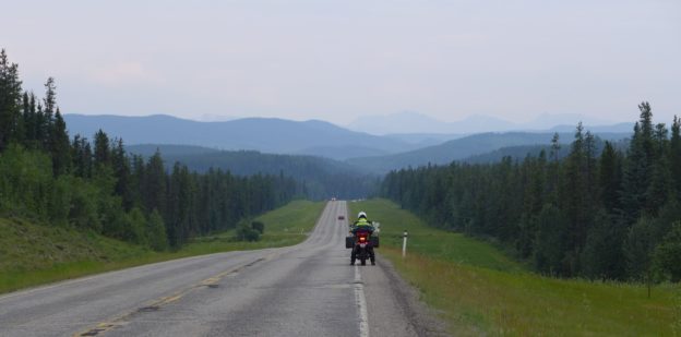
North of Fort St. John the farming disappeared almost immediately and for the last 200 miles of our ride today the road looked very much like this – chip seal, fairly smooth with wide setbacks, and green grass and trees as far as the eye could see. We rode a steady 65 mph (speed limit 100 km/hr), and made good time. The drivers here in Canada are all very observant of the speed limits – impressive.
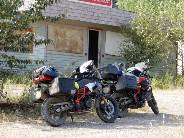
With about 100 miles to go we were in need of a rest stop but couldn’t find anything with shade. Then we came on to this deserted restaurant/service station – it think it is called Prophet River – and found some shade for sharing an orange and a cool drink of water. I imagine this place was doing a good business in 1958 when I first came up the ALCAN.
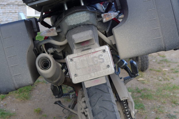
We got to our motel around 5 PM today. I hadn’t expected the bikes to get muddy until we get on the Dempster but during the rain this morning the dirt that cars and trucks had tracked onto the highway from side roads turned to mud and made a mess, and then we came to a section where they were doing road work and we rode on wet gravel/mud. Oh well, I guess it was good practice for the Dempster.
It dawned on me today that this ride is loaded with “beginnings”…
- Beginning the trip when I left Cleveland
- Beginning the “real ride” when I met Paul and we headed for Canada
- Beginning the ALCAN highway – the road to the north
- Beginning the Dempster Highway – 500 miles of gravel to Tuk
- Beginning the rode back when we leave Tuk