Wednesday, August 15
Skagway, AK to Teslin, YT
158 miles; sun and clouds; temps 42 to 60
Before I left Skagway this morning I made motel reservations from here down the Cassiar Highway. I couldn’t get a room at the town of Cassiar when I wanted, so I had to modify my plans making more and shorter days. So today was an unusually short day, and boy what a difference it made in the ride – I now had time to stop to take photos, read signs, take in the views, and chat with folks I met along the way. I’m looking forward to the next four or five days when I can continue this relaxed pace and indulge my curiosity.
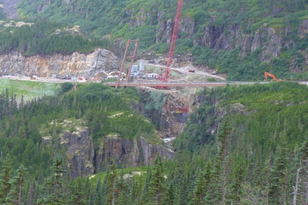
For the first fifteen miles out of Skagway the Klondike Highway climbs up and over the rugged Coast Mountains making for a dramatic ride. The grades are steep, the drop-offs precipitous, and the views stunning. In one section (above) a cantilevered bridge crosses a canyon coming down the mountain – the bridge is entirely supported from one side.
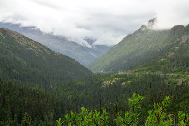
This morning the mountain tops were hidden by clouds, but you could still get a good sense of the scale, Here the Klondike Highway scales the northwest side of the canyon, and the White Pass and Yukon Railroad (not visible here) goes up the other side. Many of the Klondike stampeders took the route that the railroad eventually followed and there are stories of pack animals and even prospectors falling off the narrow trail to their deaths below.
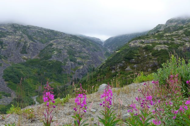
The Coast Mountains have a rugged beauty and immediacy that comes from their being so close to the highway. Here again the clouds hide the tops. Near White Pass the temperature dropped to 42 degrees, but the heated grips on the Little GS provided a nice touch.
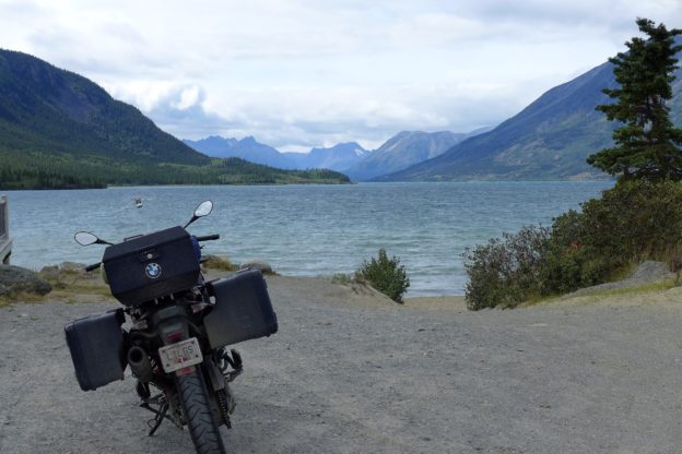
Most of the gold rush prospectors reached the Klondike following a route from Skagway over Chilkoot or White Pass to Whitehorse. Once they made it over the mountains they continued overland another 50 or 60 miles to Bennett Lake, which flowed into Tagish Lake at Carcross (above), and eventually the Yukon River and took them to Dawson. If I had been here 120 years earlier I would have seen many, many boats of all descriptions coming down this passage headed for the gold fields.
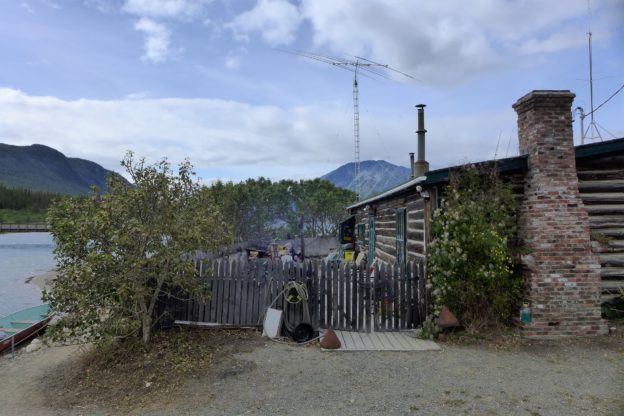
Wandering around Carcross I noticed this log home with a ham radio antenna mounted on a tower outside. It gives new meaning to the term “ham shack.”
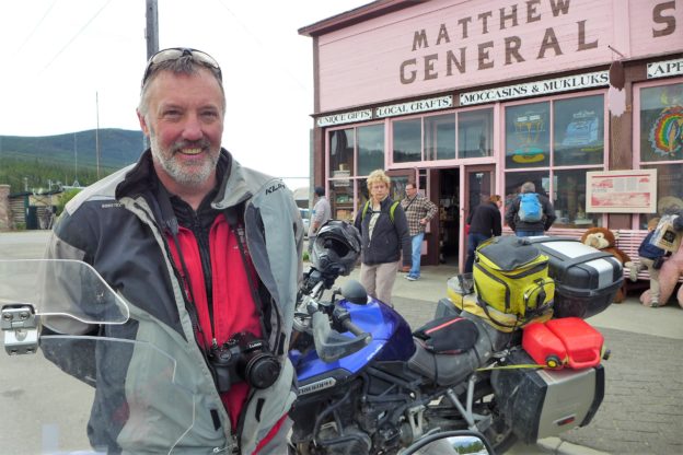
While in Carcross I noticed three motorcyclists pull in on GS type bikes so I rode over to see if they had by chance been up to Tuk. Sure enough, they were there about a week or ten days ago. Andrew (above) from Vancouver said most of the road was fine, but there was a stretch of 300 metes or so that was very slippery and many folks dropped their bikes (no harm done if riding cautiously), and between Inuvik and Tuk much of the road had deep gravel which was challenging to ride through. As he said, the condition of the road depends entirely on the weather. Since they had rain in TUK during the time we had planned to be there it is probably just as good we didn’t get up there to try it. At the least we would have had to wait for dry weather before giving it a try.
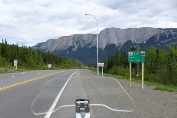
At Carcross I took the Tagish cutoff and joined the Alaska Highway (above) going east toward Watson Lake. I will be going back to Watson Lake the same way I came up a week ago, but this time I’ll connect with the Cassiar Highway at Watson Lake and head south.
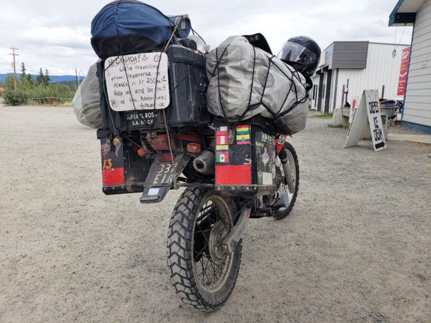
I got to my motel at Teslin in good time. After I settled in to my room I came outside and saw this bike. It is a little Honda 250 being ridden by a young couple from Argentina to Alaska. The sign on the back invites people to help them, I assume by contributing money. They must be having quite an adventure!
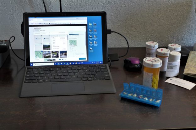
Tonight while the laptop was uploading photos to my blog I had time for a weekly household chore, refilling my pill box. I’m good to go for another week. I doubt the young couple above is bothered with this chore.
Tomorrow to Watson Lake, do some laundry, and get ready to head down the Cassiar on Friday.
Thursday, August 16
Teslin, YT to Watson Lake, YT
198 miles; sun and clouds; temps 40’s and 50’s
This was an uneventful ride today. I had ridden this route on the way up to Whitehorse so I didn’t expect to see much new.
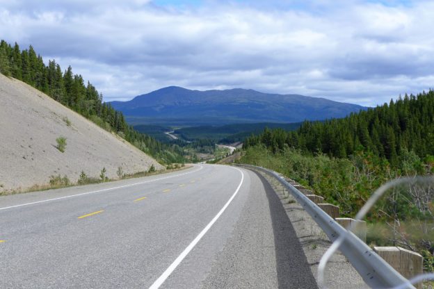
Riding across southern Yukon the views were superb as usual.
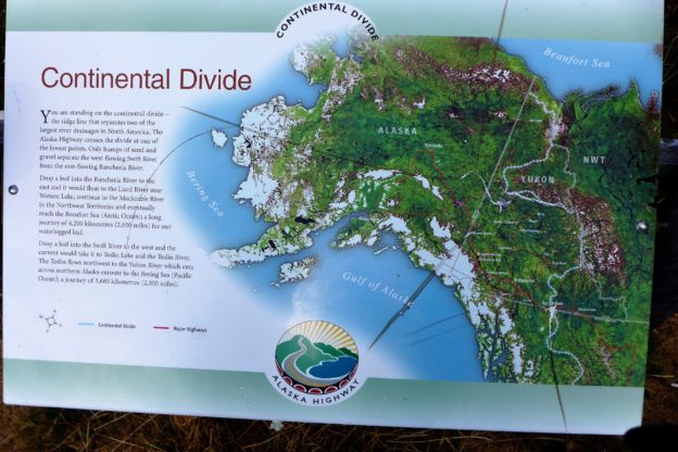
Since I was on a more relaxed pace again today I stopped at a roadside to read this sign. Glad I did. It explains that I was standing on the Continental Divide, at one of its lowest points. The water to the west of me drains into the Yukon River watershed and flows into the Bering Sea on the west coast of Alaska. The water to the east drains into the Mackenzie River and empties into the Beaufort Sea (Arctic Ocean) just a few miles from Tuktoyaktuk. I won’t get to see the Mackenzie on this trip, but I got close!
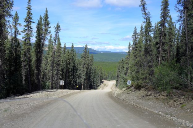
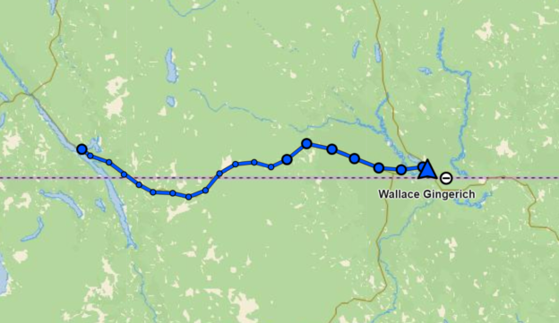
My curiosity got the best of me today and the Little GS and I decided to turn off on the gravel road that leads up to Silvertip Mine. It was well maintained since the mine was still active and big trucks were using it. Little roads like this make me feel so much closer to the landscape I’m riding through, and this would be the only significant gravel road I would ride this trip. After a while I got more relaxed and enjoyed the ride.
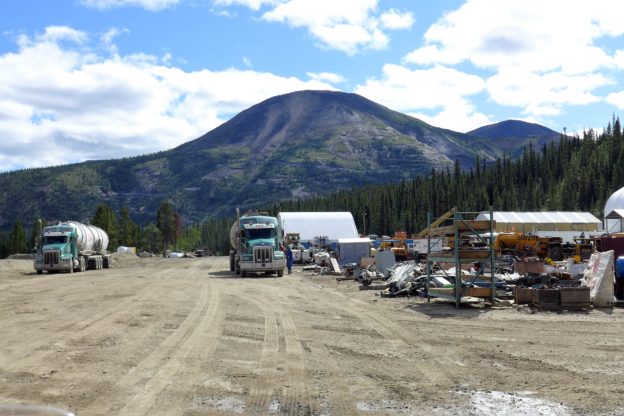
After 15 miles we made it to the mine site. The miner produces silver and lead, and seemed to be quite active. Fortunately I didn’t meet any of these trucks on the road – it is one lane with pull outs and I would have had to turn around and go back to one to let the truck pass. All in all another nice riding day.