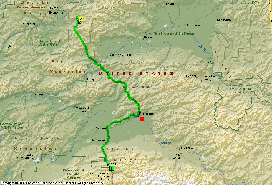
 This segment took me up to Fairbanks and then north up the Dalton Highway to the Arctic Circle. The road conditions on the Dalton were the most challenging of the trip, but the experience at the Arctic Circle was unforgettable.
Day 21 – Thursday, June 21 – Arctic Circle
I left Healy, just north of Denali Park, this morning and rode north to Fairbanks.
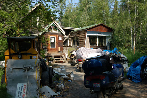
Before leaving Fairbanks I wanted to look up Trail’s End BMW. George, the proprietor, is something of a legend. You can see here that his establishment is a bit out of the ordinary.
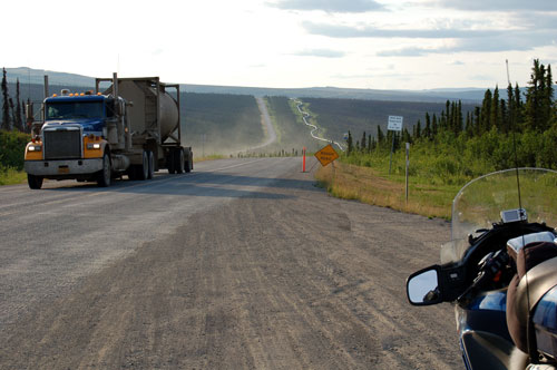
I wanted to ride the Haul Road (Dalton Highway) up to the Arctic Circle, but I wasn’t sure my big LT could make it. The Haul Road was built in the 1970’s to construct and then service the pipeline from the north slope to Valdez. I had been getting varying reports from locals, and those who had ridden it lately, and decided I would check it out for myself. The Haul Road is legendary – muddy and slippery when wet, dusty when dry, and always under construction. Big trucks create dust clouds and kick up rocks as they pass.
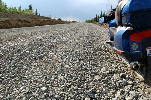
I rode west out of Fairbanks on the Steese Highway to the Dalton Highway. The Dalton started fairly good, but I soon reached an 11 mile section where they were rebuilding the roadbed. You can see here the size of the rocks – and they were loose. I almost dropped the bike several times, but hung in there and made it through this section.
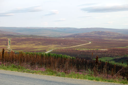
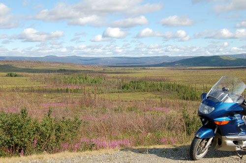
The arctic tundra has a beauty and remoteness that is something to behold. The first 50 miles or so were boreal forest, and then it was tundra, as you see in this photo. The pipeline is on the left, and the Haul Road is on the right. Views like this extend for miles and miles, and knowing that there is no one there except for people on the road gives one the feeling of being really alone and in a different world. I love the feeling of being in remote, northern places.
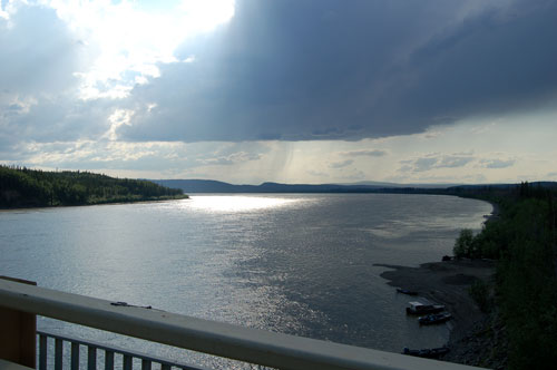
Fifty-six miles up the road I crossed the mighty Yukon River. The headwaters of the Yukon are south near Skagway, where the gold prospectors went to take the Chilkoot Trail across the mountains to get to the river that would take them up to the gold fields at Dawson City in the Yukon. An alternative route was to sail north on the Bearing Sea to the mouth of the Yukon and then take a paddle wheeler up the river to Dawson City.
Here is another view of the Haul Road and the pipeline. Trucks and tourists are the travelers of the road. The trucks supply the oil drilling facilities at Prudhoe Bay, and provide support for the pipeline.
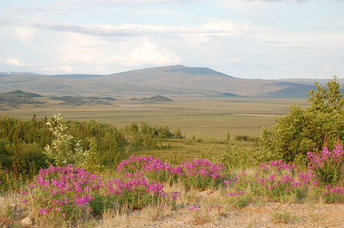
Fireweed is plentiful along the Dalton Highway. It is one of the first plants to grow in areas where forest fires have been, as you can see in one of the photos below. The low light this evening (around 10 p.m.) made for some beautiful views of the landscape.
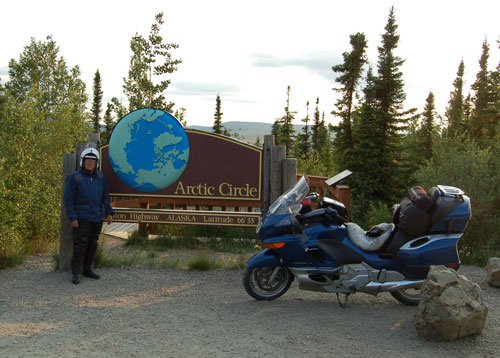
I reached the Arctic Circle, milepost 115 on the Dalton Highway, at around 10 p.m. I had seen photos of other bikers at this sign, and now I had made it myself. I felt a sense of accomplishment knowing I was actually in the Arctic, and being there on the summer solstice added to the experience. I was filled with anticipation and excitement. I was a bit overwhelmed…
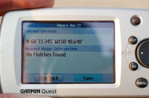
My GPS verified that I was at 66º33‘ latitude, which defines the Arctic Circle.
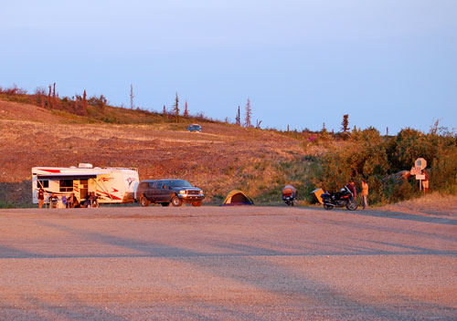
I rode north another 17 miles to Gobbler’s Knob to watch the solstice from the top of a ridge looking with the Brooks Range crossing the horizon. I was not alone. Folks from Michigan, California, Alaska and elsewhere had come to watch the solstice. This photo was taken around midnight and, as you can see, it was not at all dark.
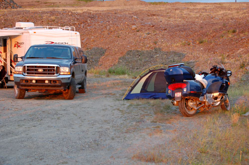
The mosquitoes were bad. I decided to put up my tent to provide relief, and I could watch the solstice from inside…
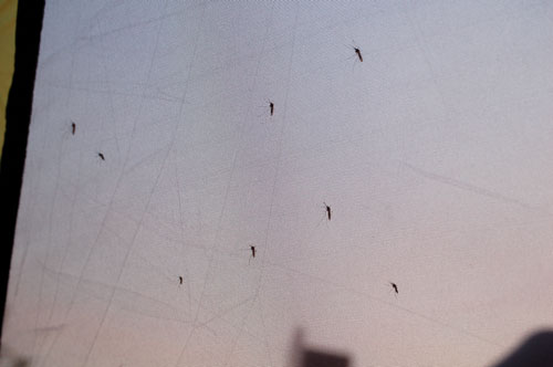
The mosquitoes were thick! Actually, this was an unusually low time for mosquitoes, owing to the relatively dry spring weather and it being early in the season. Locals describe clouds of mosquitoes, particularly further north where there are many pools of standing water atop the permafrost. I didn’t escape entirely, however – I’m scratching a few bites this evening as I write this.
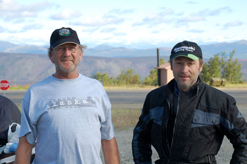
I met Dave, from Florida (on the left), and Paul, from Australia, at gobbler’s Knob. Dave rode his 1978 R90S Beemer up. Paul flew to San Francisco and bought a used Suzuki V-Strom. He plans to ride up to Prudhoe bay and then work his way down to Panama over the next six months before returning to Australia. These are just two of the interesting people – bikers and non-bikers – I have met on the trip. I expect to see Dave at the BMW national rally in West Bend, WI in mid-July on my way home. (This photo was taken around midnight.)
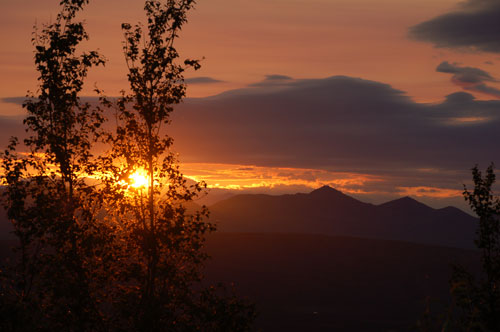
I took this photo sometime around 1:30 or 2:00 a.m. on June 22. I had to use a tree to block part of the sun so the horizon would be distinguishable. The mountains are part of the Brooks Range.
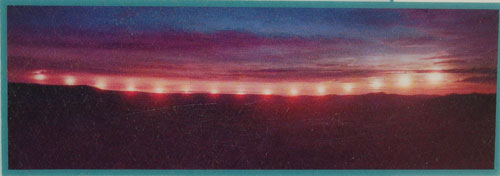
This time-lapse photo from an interpretative display shows nicely what I saw this evening. The sun just skimmed along the horizon, never dipping completely out of site, and then eventually (around 3:00 a.m.) began to rise. I finally drifted off to sleep…
Day 22 – Friday, June 22 – Arctic Circle
I really wanted to continue all the way up the Haul Road to Prudhoe Bay on the Arctic Ocean, but that would have been another 400 miles on gravel with a bike not well-suited to the task, plus I’d heard that the road conditions deteriorate the closer you get to Prudhoe Bay. So, reluctantly, I decided to leave that for another time.
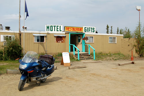
This morning on the way back to Fairbanks I stopped for gas at the Yukon River. Complete services were available, including food and rooms along with gas. This was the only gas available until outside Fairbanks, about 130 miles away.
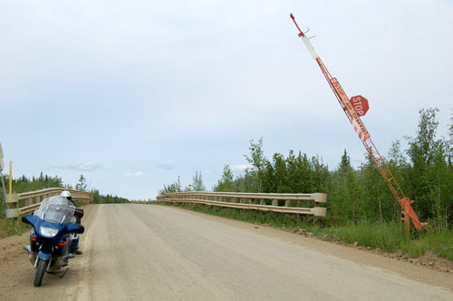
This is the first time I’ve seen a stop sign for air traffic. The road runs along side a landing strip here and curves around it at the end. When a plane comes in for a landing the arm comes down and highway traffic stops. No planes were in the area today so I buzzed on through.
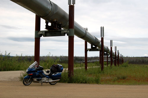
The pipeline is an impressive engineering feat. It’s probably 4-5 feet in diameter and is built above ground much of the way – in areas where permafrost is an issue. The oil is heated to keep it moving easily, so the pipeline must be insulated from the supports to keep them from melt the permafrost and sinking. The pumping station north of where we watched the solstice actually had to slow down the oil as it was coming down the mountains. I hope to learn more later on, as I will be paralleling the pipeline most of the way down to Valdez, the southern terminus.
This morning – or was it afternoon – I was struck again by the solitary beauty of the arctic landscape.
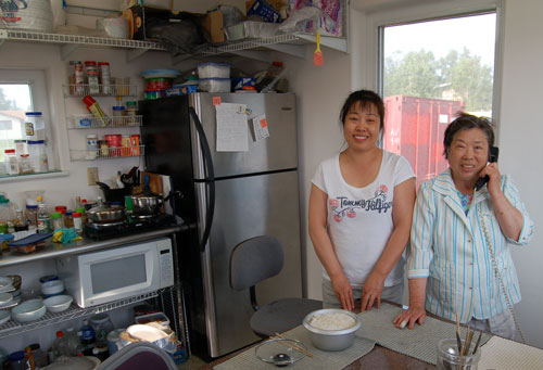
I got to Fairbanks around 6 p.m. and pulled into the parking lot of a small motel (and florist and beauty shop). Insoo (on the left here) met me in the parking lot and insisted I eat with her and her mother – she was cooking fresh salmon for a group of guys who had stayed there for the week and had plenty. It was delicious! We ate in the freestanding kitchen Insoo built for her mother. Insoo, didn’t want the smells of her mother’s traditional Korean cooking in the main house. Of course I was reminded of my good friend and colleague, Insoo Kim Berg, who died recently. Both Insoos were very friendly and outgoing.
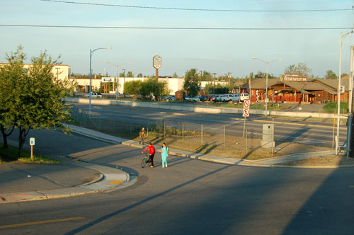
It got to be 11 p.m., bed time, but I didn’t seem tired. The reason why – it’s still very light outside up here and people are walking around as if it were 7 or 8 p.m. back home. I have to monitor the time and get myself to bed when it’s time, or I sleep much too late in the morning and don’t get on the road until nearly noon!
Day 23 – Saturday, June 23 – Fairbanks
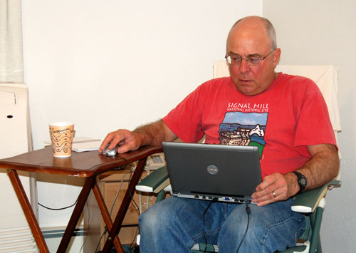
Today was a day for laundry, drying out my boots, doing preventive maintenance on the bike, catching up on sleep, and updating my web site. That involves selecting the images I want to post, converting them to a format for the web, constructing the actual web pages, then uploading them to my site on the internet. As you can see here, gin and tonic (in the coffee cup) makes the task much more enjoyable.
